We spent the next six days and five nights in the backcountry of
Kings Canyon National Park, hiking the Rae Lakes Loop. It was an awesome
and eventful few days. In the interest of catching up, we will tell the
story mostly through pictures and captions. The image below shows the elevation profile (peaking at Glenn Pass) and the map of our route. We started at Roads End on the far left and hiked clockwise. As always, we welcome your comments!
 7/12/11
 |
| Our first morning started in the front country with the breakfast of champions, oreos and cheesecake puddin'. |
 |
| I went on a ten minute errand to rent a bear canister that ended up taking about two hours. It's a long story: I parked in a no parking zone and got yelled at, got both a permit and a canister and finally returned to this scene. Notice, Robert is all packed and I have yet to begin. |
 |
| Before the hike |
 |
| Purdy flowers along the hike |
 |
| Mist Falls, notice how misty it looks. OOh! |
 |
| The mist made an awesome rainbow. |
 |
| Make that TWO awesome rainbows!! |
 |
| This is at our first campsite in Lower Paradise Valley Campground. Robert is unpacking all our tasties from the giant bear canister. (Not all our food fit into even the largest canister so we made good use of the old, rusted metal food lockers at the developed campsites along the way. Vegetarian fare is not as calorie dense as "hand meat," it seems.) |
7/13/11
 |
| The morning of our second day, we found these gorgeous Tiger Lilies. |
 |
| A juvenile American Robin. Momma squawked and dove, but Baby was adamant about have his portrait taken. |
 |
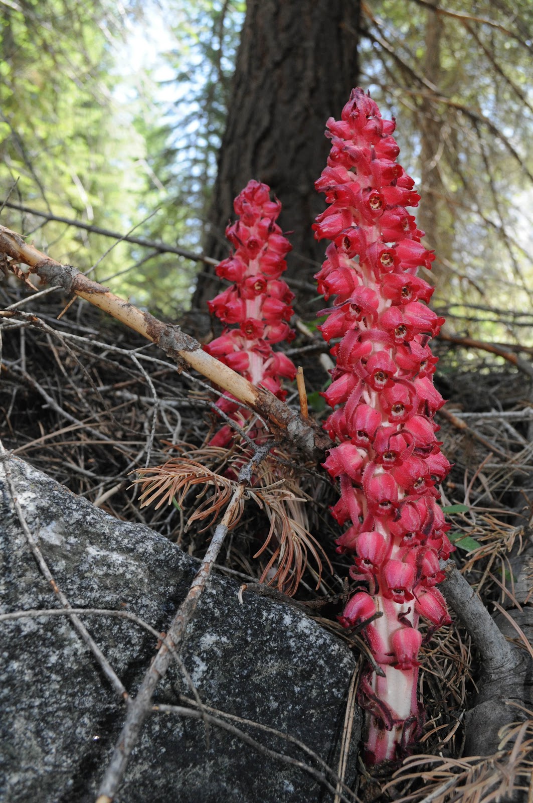
| These red asparagus-like fungi kept popping up in the shadows along our route. |
 |
| Mid-morning we got to cross this very sturdy bridge. A rogue Boy Scout is beginning to cross the bridge as well. They were plentiful along the trail and remarkable in their unpreparedness. (They ended up cutting their hike plan short and turning around halfway, good decision.) |
 |
| The end of the second day of hiking had a plethora of trees fallen across the trail. The going was very slow. |
 |
| I conquered this behemoth of a fallen tree. |
 |
| The sap from the fallen tree dripped and refracted the light, causing me to take a long break to adequately capture its beauty. |
 |
| Lizards scuttled everywhere at this elevation. Our favorite were brilliant blue on the underside. This guy was tolerant of my "big eye" until dinner came along and he needed to gobble it up. |
 |
| I make Robert pause and get his picture taken next to most, if not all, the trail signs we see. I love them. (Trail signs are marks cut into trees, a short rectangle above a tall rectangle, similar to a stocky "i." They are a more permanent version of a rock cairn it seems.) |
 |
| Looking up the valley as we expect our second night's camp to be near. (It is always dangerous to have expectations along the trail. It took quite some time longer for us to reach our days' end.) |
 |
| Castle Dome Meadow. I needed to get some hitchhikers out of my boot, but it also made for a good pic. |
 |
| We finally reached a campable spot. It was hiding from us behind this GIANT, BEAUTIFUL suspension bridge. Only one person was allowed on the bridge at a time, making me distrustful. I held on, tight. |
 |
| We cooked "Black Bear Mountain Potatoes" for dinner. Can you guess whose is whose and why it would be called that? (Our portions were a little out of control on this hike. I literally could not fit enough calories in my belly; Robert had no problem, frequently finishing mine when my eyes rolled back into my head. |
7/14/11
 |
| This is the view from the inside of our tent. |
 |
| The morning of the third day started easily enough, but the day just kept going and going. |
 |
| Robert is a crafty stream crosser. At this crossing, I followed the two hikers ahead of us through a bushwhacking extravaganza that took forever. Robert waited for me on the far side, long done. |
 |
| This stream crossing had us both miffed. We were thankful to find this log a good 150yds upstream of the trail, but it was dangerously wet across the middle. Robert stayed on his feet, but I ended up crawling across the wet bit, very elegant. |
 |
| Oftentimes while hiking, I will find something cool to take a picture of, leaving Robert to hike ahead a lot. Occasionally my lengthy delays are rewarded with cool pictures, like this giant fly sucking the guts of a small bee-mimicker! |
 |
| Jenn joined the anti-mosquito militia at Dollar Lake. (We didn't stay long, despite needing a place to eat lunch.) |
 |
| Lunch was further delayed as we navigated a maze of icy ponds and streams. We opted to cross this guy before lunch so we could dry off as we ate. It was deep, but the current wasn't strong. So long as you could direct your instantly numb feet and legs to the submerged rock path, you wouldn't get too wet. Another hiker came along as we were finishing lunch, she unfortunately was much shorter than us and got wet up to her belly button. Amusingly, but necessarily, she removed her pants for the crossing, at least she only got her unders wet and not her pants! |
 |
| This little bug friend amused us as we waited for our Ramen soup to boil. We had found a campsite at Rae Lakes, where it was cold and grey, but gorgeous. |
 |
| A hiker's best friend, anticipation of which got me through the inordinately long afternoon times. |
 |
| Painted Lady Mountain reflected in the last of the Rae Lakes. |
 |
| This German Trout didn't seem to mind the frigid waters. There were millions feeding as we wandered around the lake area in the late afternoon. We wanted to glimpse the dreaded Glenn Pass and perhaps find some makeshift trekking poles for the next day's snowy path. |
 |
| On our way back to camp from our walkabout, we stalked these stately deer as they munched. Check out the rack on that guy! |
|
|
|
7/15/11
 |
| We slept little, thoughts of Glenn Pass and mountain lions terrorizing us. The moon was full, which was crazy cool though. I am eating a cereal breakfast before we set out to conquer Glenn Pass. |
Glenn Pass. Let me explain. The loop we chose was marked as moderately strenuous, except for Glenn Pass, which we were repeatedly told not to attempt sans trekking poles. The trail was snowed over at difficult locations; hiking poles were absolutely necessary. Robert and I don't own trekking poles. What should we do? Not go on this awesome hike? Nah. We are young and invincible. We shoved thoughts of the pass out of our minds, hiked deep into the backcountry and then got slapped in the face by the sheer magnitude of the pass. Our original plan was to take a day of rest at Rae Lakes and continue through the pass the next day, but we revised the plan after being scared out of our fantasy world by a ranger and multiple other hikers. We would head through the pass immediately, having enough food to turn around shamefaced if we got in over our heads. Here goes nothing!
 |
| I survey the pass. Oh god. (While I didn't know it at the time, the "trail" was in fact what I took to be goat tracks to the right of the center prominent peak.) |
 |
| The lower part of the hike up to the pass was not so bad. We joined forces with two fellow hikers, helping each other locate the trail as it disappeared under snowfields and such. They are the little specs in the bottom left corner of this scenic shot of Rae Lakes. |
 |
| Robert waits for hiker friend, Jason, to cross an annoyingly deep stream. Glenn Pass is directly ahead. We cross a few more snowfields before getting to the rocks to the left and scrambling up those instead of the steep snow. This gets us to the bottom of the pass. |
 |
| Robert stands in the middle of a snowfield. The tracks to
his right were deemed too steep, so we crossed to the rocks and just
scrambled up them, thankful not to be on snow for a while. |
 |
| Here Robert and two other hiking pairs scramble up the rocks. |
|
|
 |
| Robert and I got our picture taken in front of Glenn Pass. Would we pass through it or turn around? At this point, we were unsure. We sat on this rock while the four guys ahead of us attempted the pass, unwilling to begin until we had seen them complete the entire climb. |
|
 |
| No pictures were taken until we, ourselves, made it to the top and made it we did!! It was hard and scary and I wanted to turn back when I had to scramble from rock to snow for the first time and couldn't find any stable holds, but Robert helped me get on solid footing and away we went. Step, stick, step, stick. Very slowly, oh so very slowly, we conquered the mountain. This is a view from the top, looking down on our snow tracks in the foreground and a frozen lake and Rae Lakes in the background. |
 |
| This is a view up the mountain's spine. We have just climbed up the left side and will soon descend the right. |
 |
| Portrait overlooking the Rae Lakes side of Glenn Pass. We rested and drank the scenery until the hour got late and we were forced to move on. |
 |
| Full view of the Rae Lakes side of the pass. |
 |
| Here is another considerable jump in time, no pictures were taken during the first part of our descent down slippy granite trail cuts. The regular trail would have been a cakewalk, but the edges of most of the switchbacks were snow covered forcing us to scramble down to the next level of trail via goat paths. This is a frozen lake at the first bit of level ground, we got water here and it was delectable. |
 |
| Not sure of this fella's name, perhaps Mt. Rixby? Regardless, the scenery on this side of the pass didn't disappoint. The trouble was we had expended a good portion of our energy and day getting up and over the pass and had little left in the tank for the rest of the hike towards Vidette Meadow, the first decent camping spot. (Two miles closer than we had originally planned) |
 |
| In fact, we didn't even make it to Vidette Meadow that evening. We heard the bugs were terrible there and we were shot to hell, so we stopped at this small camp spot, inches past the 10,000 feet sign, past which fires were allowed. |
 |
| We supped on Ramen noodle soup and pasta with red cream sauce. We underestimated the reflective power of the snow and burned the crap out of our faces. |
7/16/11
Technically this was our rest day, but we hiked a bit to decrease the mileage we would have to hike the next day. We took a long lunch and made trail quesadillas and ate pre-packaged Indian curry and read for a long time. Then we needed a campsite, we were knee deep in overnight-hiker territory so the campgrounds got full and intolerable. We pushed on, hoping to find a small patch to ourselves.
 |
| Burgeoning fungi |
 |
| Multi-tiered waterfall that refused to be captured adequately on film. |
 |
| Eventually we stumbled up this campsite, complete with old food lockers for our dirty dishes. It was located where Charlotte Creek emptied into Bubbs Creek, which was anything but a creek, snow melt causing it to swell to mammoth proportions. We spent the afternoon dipping our feet into the creek and reading our books, perhaps more necessary than trekking poles! |
7/17/11 - Hiking out!
 |
| Immediately after breaking camp, we had to navigate a maze of stream crossings. Apparently, Charlotte Creek has spilled its banks with meltwater and one stream multiplied into millions. |
 |
| It took us less time than expected to hike out. We were returning our bear canister at about 1:30pm, rather than the expected 3pm. We had plenty of time to get a California Fire Permit (allowing us to wield flame on Forest Service land), get two Bear-shaped tokens for laundry, two plump rectangle tokens for showers, and spend $50 at the overpriced market (two pots, two toms, an onion, mixed six-pack of good beer, 12 pack of Bud, and a package of moldy marshmallows). |
 |
| We lounged in the parking lot by the showers, drinking local beer, until we had enough energy to get clean and what a glorious cleaning it was. I am not wearing socks in this photo. :) |

 7/12/11